

Last summer, we drove down in our van to northern Spain and explored Aragon as a family. Our goal? Beautiful mountains for hiking and good food: Aragon offered us all that and even more! We were delighted by the varied landscapes, from mountains to plains, with pretty rivers. We even enhanced our family hiking experience with a canyoning outing! A first for the children! Great memories! I’m going to break down our 6-day road trip through Aragon, from the Pyrenees border down to Zaragoza, and share our 10 family hikes in Aragon!
Time of year: the 3rd week of July
Children’s ages: 13 and 15.
To keep it simple, among our 10 hikes there are 5 short and easy hikes and 5 moderate-to-challenging hikes, including one canyoning hike! So there’s something for every level! You can therefore imagine a less sporty version of our Aragon road trip by choosing the easy walks and easier variants. On top of the hiking programme, there’s plenty to enjoy between swims in rivers and waterfalls (the children loved it!) and visiting villages. Below, I’ve listed our hikes in chronological order of our 6-night road trip in Aragon.
Here are all the details of our 10 hikes in Aragon!
1 – The Hunter’s Trail hike (Ordesa y Monte Perdido National Park)
Sporty hike, medium difficulty – 20 km loop – 750 m elevation gain – 6 hrs with a picnic break (7 hrs advertised)
After a quick breakfast, we park at the large car park in Torla, where you have to take a bus to the start of the hikes (the bus runs every 15 minutes from 7am). It’s a bit frustrating to start a hike by taking a bus, but apparently, in high season, there isn’t enough parking at Ordesa (the start of the hikes). It’s also to avoid too much traffic on winding roads.
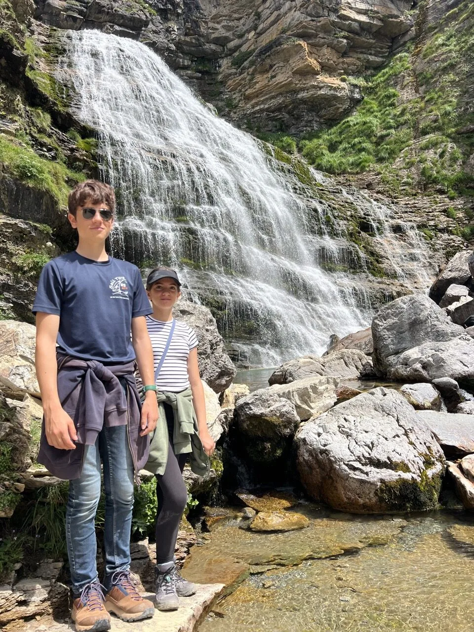
We start the Hunter’s Trail hike (senda de los cazadores) at 8.30am and walk anti-clockwise. That way, we begin with the hardest part: a steep climb that lasts 1 hour 30 minutes. There are very few hikers on this trail because most visitors choose the waterfalls hike (see the shorter version below).
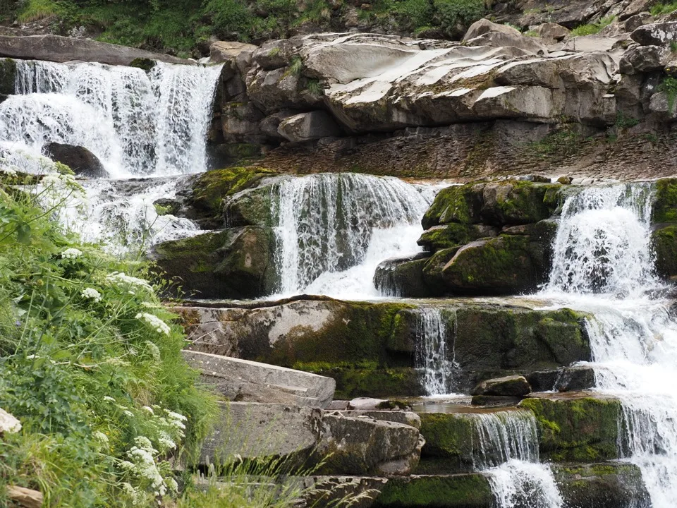
After our big ascent, we reach Faja de Pelay, a balcony path, fairly narrow but easy, offering magnificent views of the mountains. We catch sight of the Breach of Roland, which we’d already seen in France on a hike at the Cirque de Gavarnie.
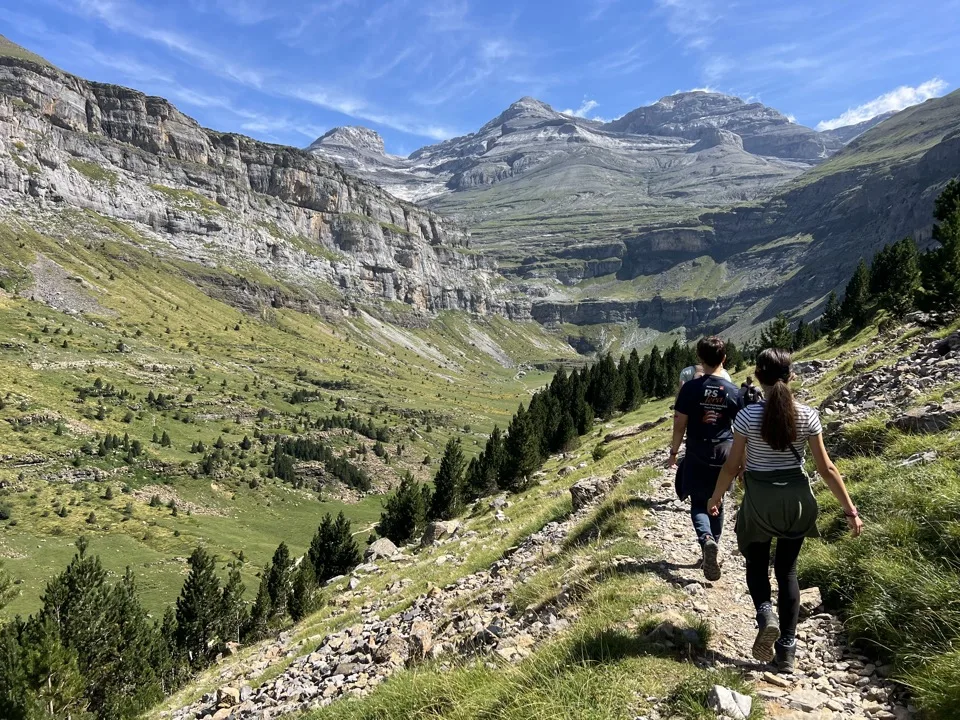

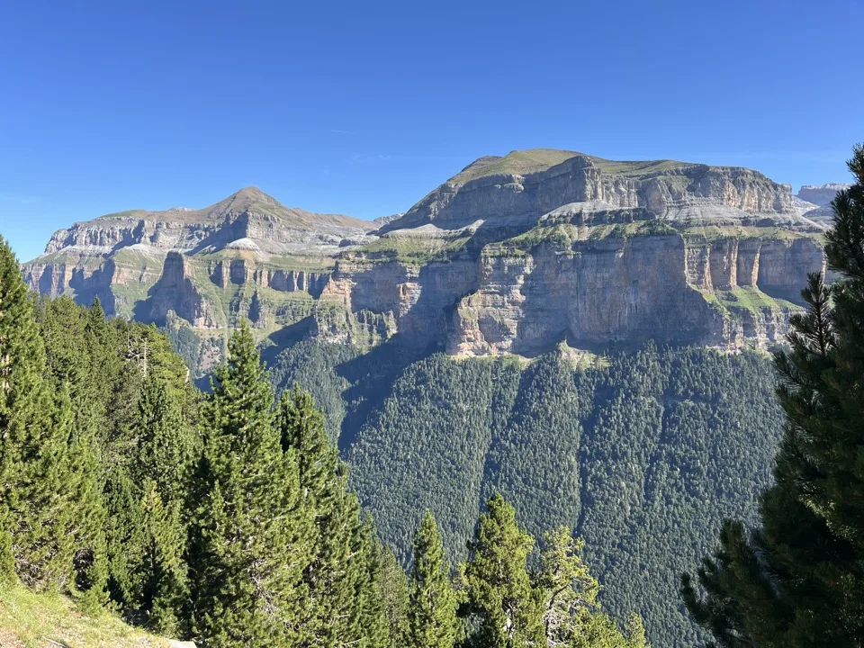

Along the way, we come across edelweiss and elegant lilies. We picnic by the path, before the long descent towards the superb Cola de Caballo waterfall. There, we meet the other hikers who had chosen the easy option on the lower path. On this lower part of the hike, we come across cows playing us music with their bells. We follow the river and pass other waterfalls, such as Cascade del Estrecho. Near the end of our loop, we even spot a doe!

At 3pm, we’re back at the bus stop and we head back.
Easier variant: you can opt for the hike to Cola de Caballo waterfall. That corresponds to the lower part of our hike. Your route will be an out-and-back on a flat path.
Where to sleep in Monte Perdido?
We slept in our campervan at Camping-Bungalows San Antón, which was very good: quiet, very well kept, with spotless facilities. There’s also a nice, inexpensive little bar with a view of Monte Perdido. The only downside of the campsite: the pitches are small, but that seems to always be the case at campsites in the area. It wasn’t too bothersome because people were very discreet.

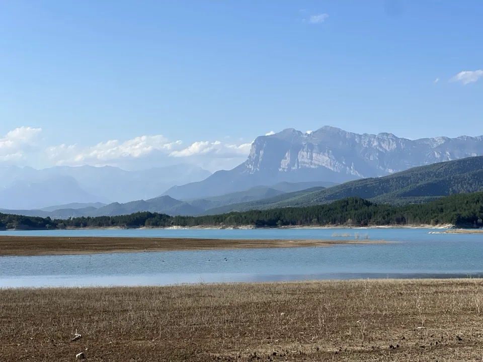
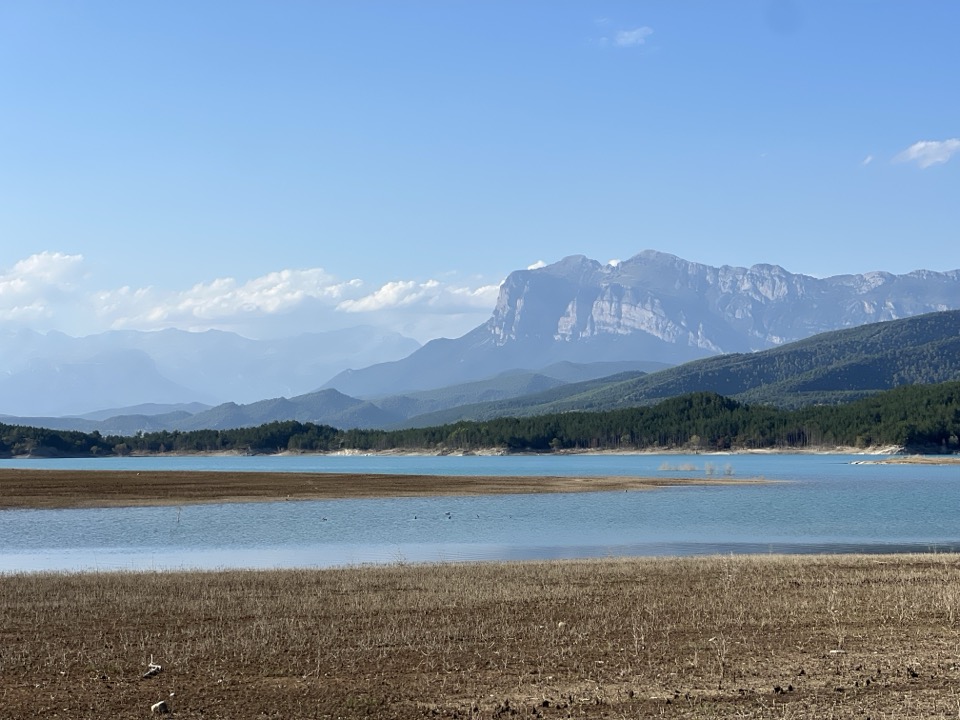
2 – Walk at the Embalse de Mediano
Easy level – flat walk – about 3 km – 45 min
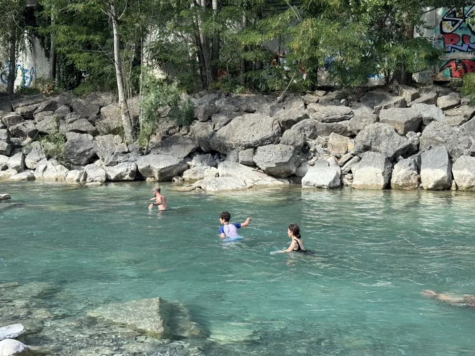
Still the same day, after our mountain hike, we drove down into the valley towards the village of Boltaña. In the village, we started by swimming in the River Ara: we loved it! There’s a bit of current, just enough to be fun without being dangerous.

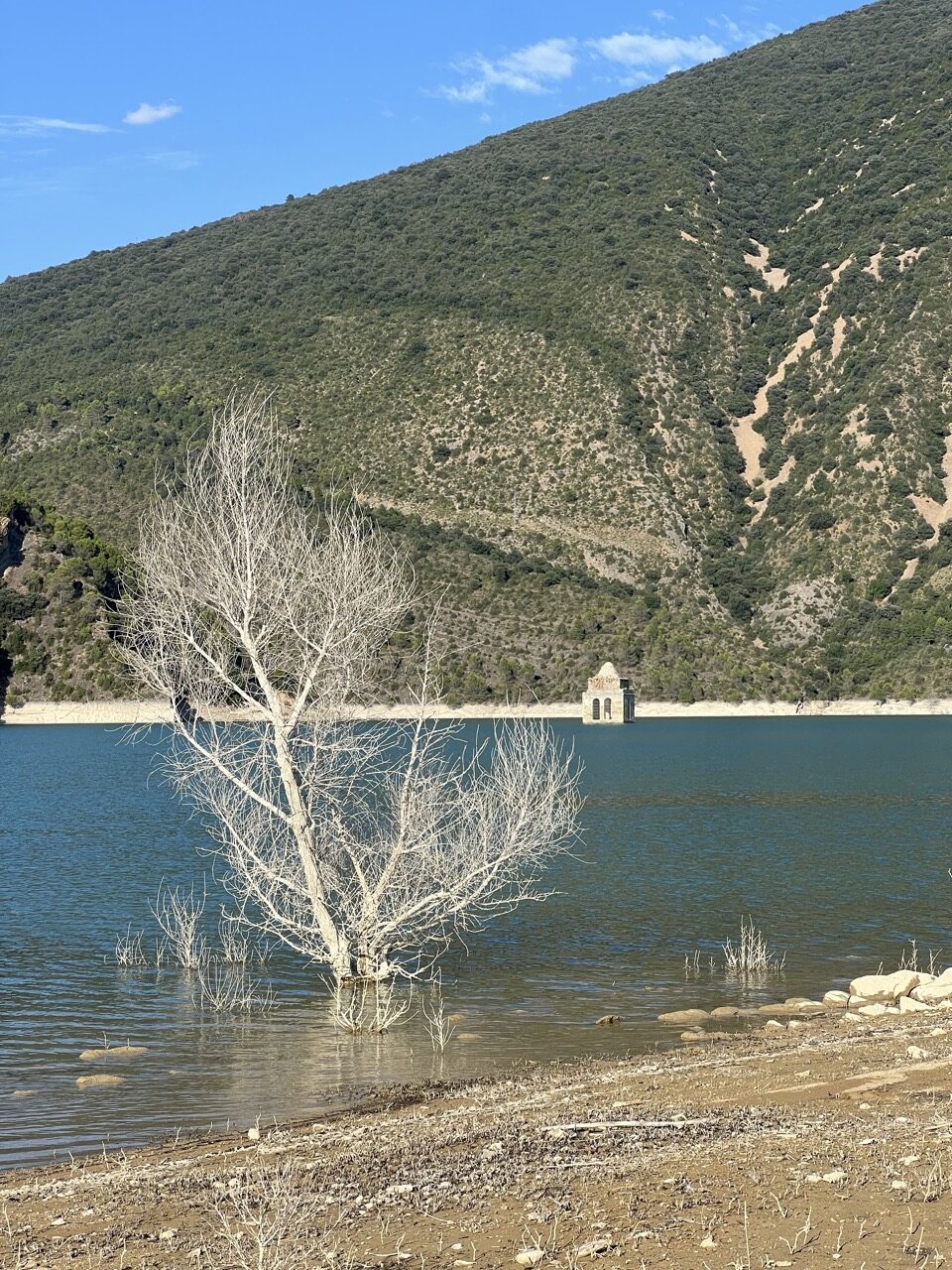
After that great swim, we headed to Embalse de Mediano, an artificial lake. We walked there in lovely sunset light. In the lake, you can see the bell tower of a submerged village. It wasn’t easy to work out where to park. We were at the point “parking kayak en Mediano” on Google Maps. From there, you walk 20 minutes to the lake, to the spot where the church is.

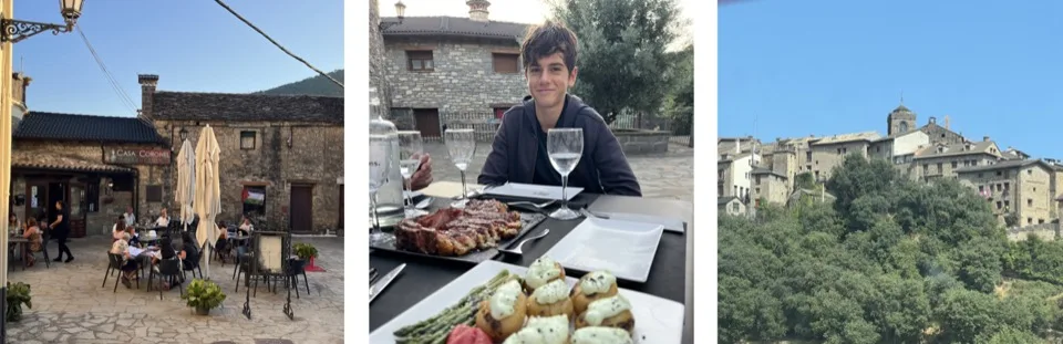
Back in Boltaña, we had dinner at a great restaurant: Restaurant Casa Coronel. We loved it, and the terrace in the middle of the old village was very pleasant:

Where to sleep in Boltaña?
We set up at Camping La Gorga, by the River Ara. It’s a very family-friendly campsite. Again, the pitches aren’t large. The atmosphere is friendly, and we liked being close to the river for swimming.
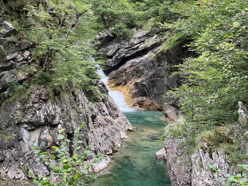
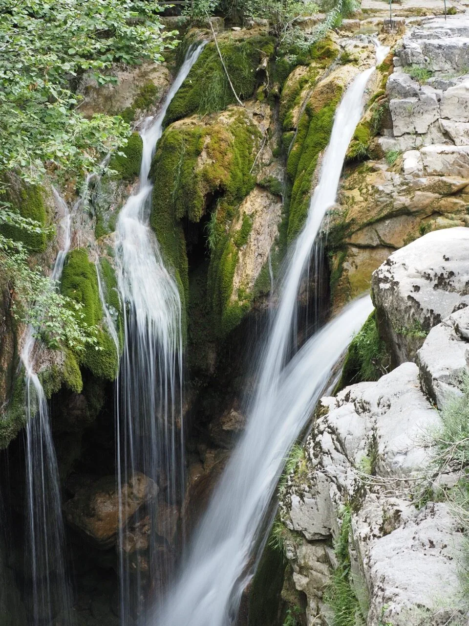
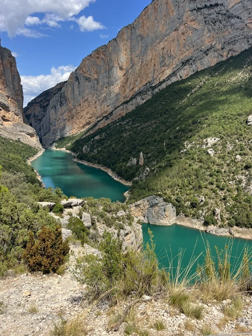
3 – Hike in the Añisclo Canyon
Easy to moderate hike – little elevation gain – 3 hrs return
After breakfast, we set off back into the mountains, heading to the start of the hike in Añisclo Canyon. In Escalona, take the HU-631 road north-west. It’s important not to arrive on the HU-631 from the west via Sarvisé, as you wouldn’t be able to access the start of the hike (the road is one-way at that point).
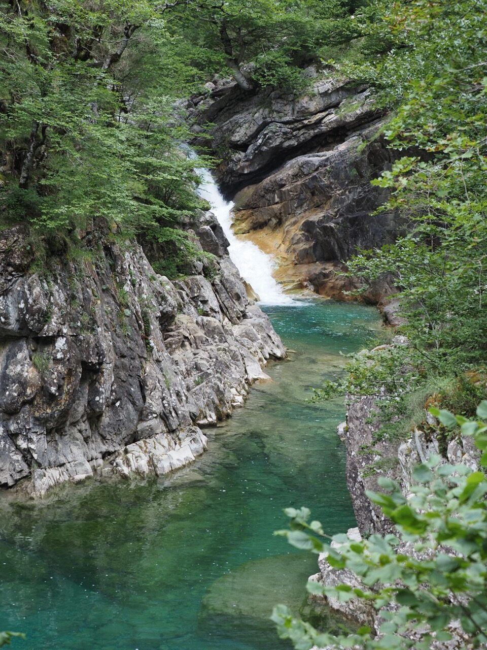
At the start of the hike, there’s a small car park (it’s best to arrive early because there are very few spaces) and an information kiosk where they give us a map. We were there at 9am. The Añisclo Canyon hike is a very beautiful hike, less well known and not very busy. We recommend it because it’s a very different landscape from the day before. The vegetation is dense. You follow an emerald-coloured river with several small waterfalls. It feels a bit Indiana Jones. There’s lots of moss on the trees, and as the walk is at the bottom of the canyon, there’s a particular atmosphere: you feel surrounded by nature!
As always, we checked the weather carefully: a few drops of rain were forecast around midday. We should have finished the hike by then. But after 2 hours walking in the canyon along the river, we hear thunder and see lightning! An unexpected, violent storm hits us! And we still had 1 hour of walking to get back to the car, with no shortcut possible and no shelter! I admit the atmosphere became scary because the lightning was close! We finished at a jog because we were eager to get to safety, not so much from the rain as from the lightning! Proof that even when you’re careful, you can sometimes end up in very stressful situations in the mountains. We had windbreakers, but after 1 hour in an intense storm, we were soaked to the bone! The rain eased as we were finishing our hike. Without the weather issue, this hike is fairly easy because the path along the river is flat. You just have to go down about 100 metres at the start to reach the canyon and climb back up at the end.


After all that, we got back in the van and drove up onto the plateau at the end of the road to have a picnic in a beautiful natural setting, with views over the canyon and 360-degree views across the plateau.
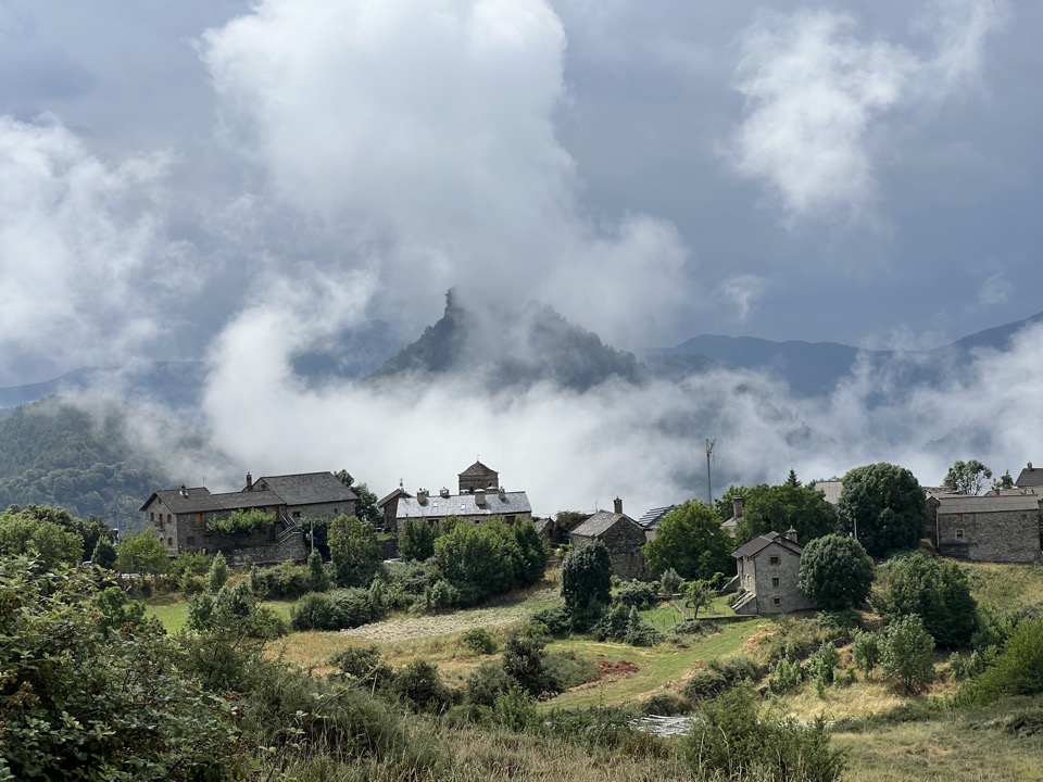
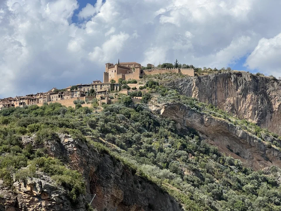
Finally, we drove back down into the valley and headed to the town of Aínsa. We wandered around its lovely stone-built historic centre.
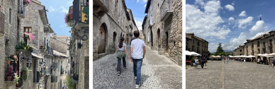

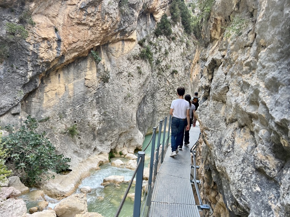
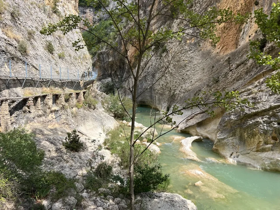
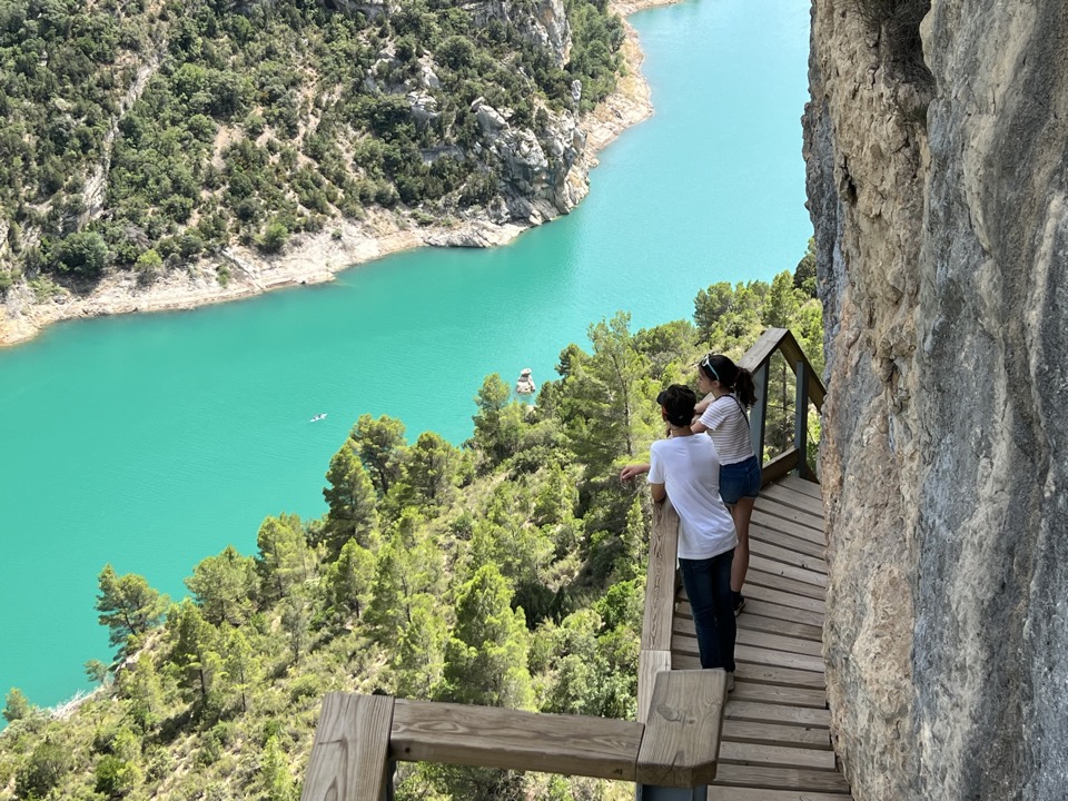
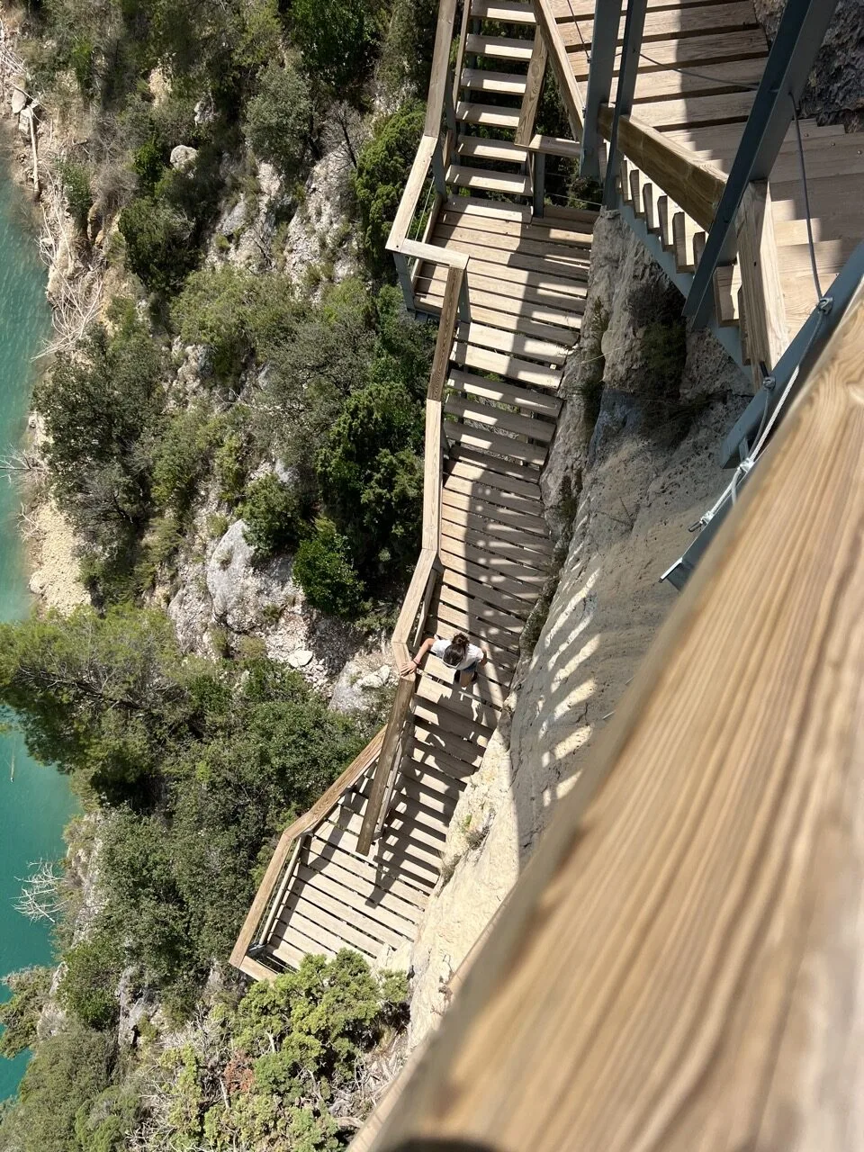
4 – The walkway route in Alquézar
Easy level – hike on built walkways – 1 hr 30 loop with stops – €5 per person (free for under 11s)
After Aínsa, we continued to the beautiful village of Alquézar, where we did the walkway hike that follows the river through a canyon. It’s like a mini Caminito del Rey. It’s really nice! The setting is superb and the walkways aren’t high, so it’s very family-friendly, even with young children. I’ve marked it as easy, but at the end of the walkway route, to climb back up to the village, there’s a fairly long slope, so it can be a bit tiring. We did it at the end of the day, with pleasant temperatures, so it was fine. Watch out for the heat otherwise! During the walk, griffon vultures flew overhead.
Note: at the ticket desk, they check that you’re wearing trainers!


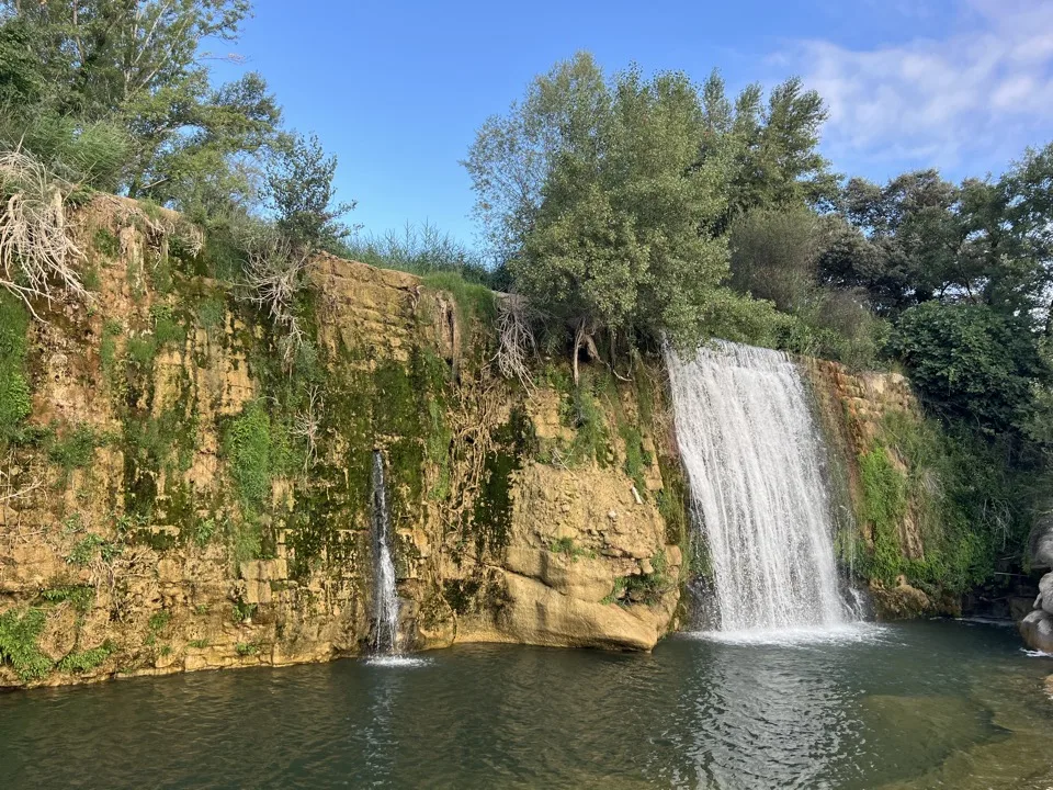
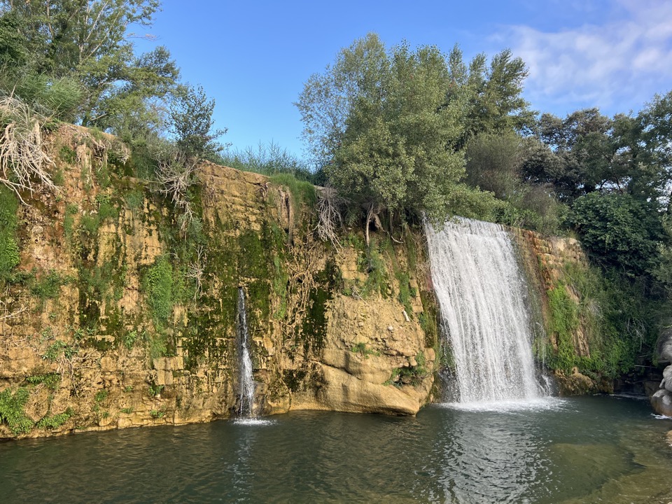
After this walk, we went for a swim at Pozán de Vero waterfall, where there were only locals. The atmosphere was really nice.
Then we returned to Alquézar for dinner at Las Melias bar-restaurant: nice! With a set menu.
Where to sleep in Alquézar?
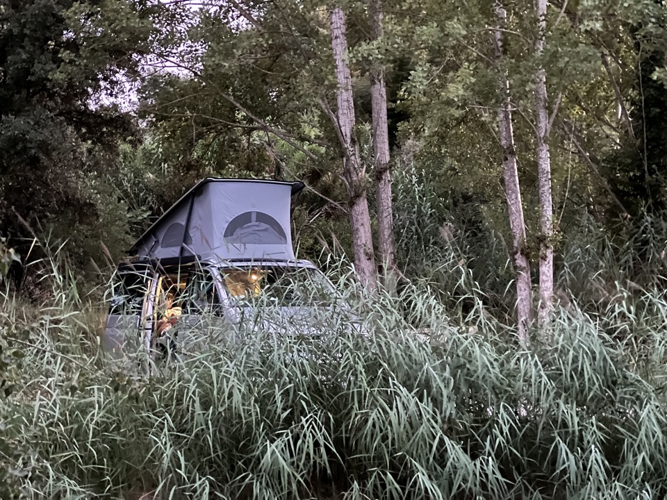
That night, we found a wild camping spot not very far from Alquézar. There are several in the area—you’ll find them 🙂
5 – La Peonera canyoning hike
Moderate to sporty level – must be a strong swimmer – 5 hrs (including 2 hrs walking and 3 hrs canyoning)
We booked a canyoning outing in Barranco La Peonera with a guide from Canyontrek Guara. It was the first time the children had done canyoning. They really enjoyed this new experience! We were with 5 other tourists. First, there’s a one-hour walk down into the canyon, then the adventure begins! For 3 hours, we follow the Alcandre River, enjoying little waterfalls, rock tunnels and the current. Along the way, our guide shows us where we can jump. We all did the jumps up to 4 metres high. Only Ticoeur and another tourist had the courage to jump into the river from rocks 6, 7 and 10 metres high! The river water was extremely clear and turquoise-emerald in colour. The water temperature was 19 degrees, but we had wetsuits. The water level was high because spring had been rainy. Some summers, this canyon isn’t doable. We finish with a one-hour walk back up on land.
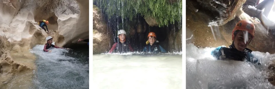

Bring a picnic, which you’ll eat at the end of the route in the river.
After picking up the car and after all those emotions, we were hungry! Off to the town of Graus, apparently known for its sausages! There are even giant sausage decorations along the main road! It’s quirky but funny. In any case, in this town, we ate unbelievably well! A very simple setting, very affordable prices, but a menu worthy of a Michelin-starred restaurant! What’s more, the chef is lovely! It’s a brilliant tip: La Bodega de Sabores restaurant. We loved the risotto and the chocolate-and-olive-oil turrón.
Where to sleep near Graus?
That night, we wild camped in our van, in a very isolated spot.
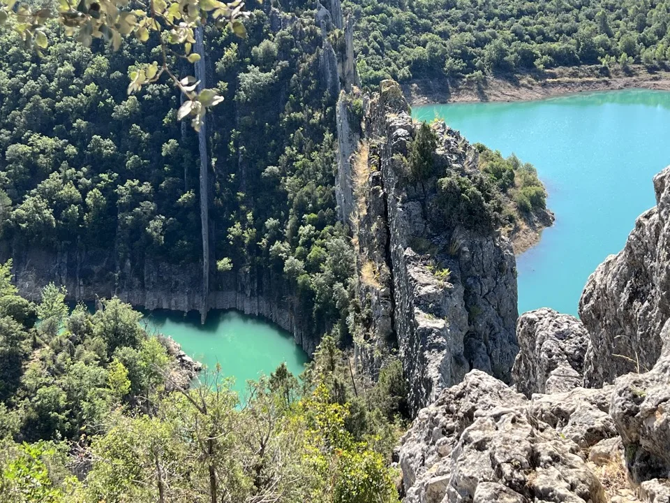
6 – Hike to the Murallas de Finestras (Sierra del Montsec)
Difficult access by car – easy hike – 2 hrs return
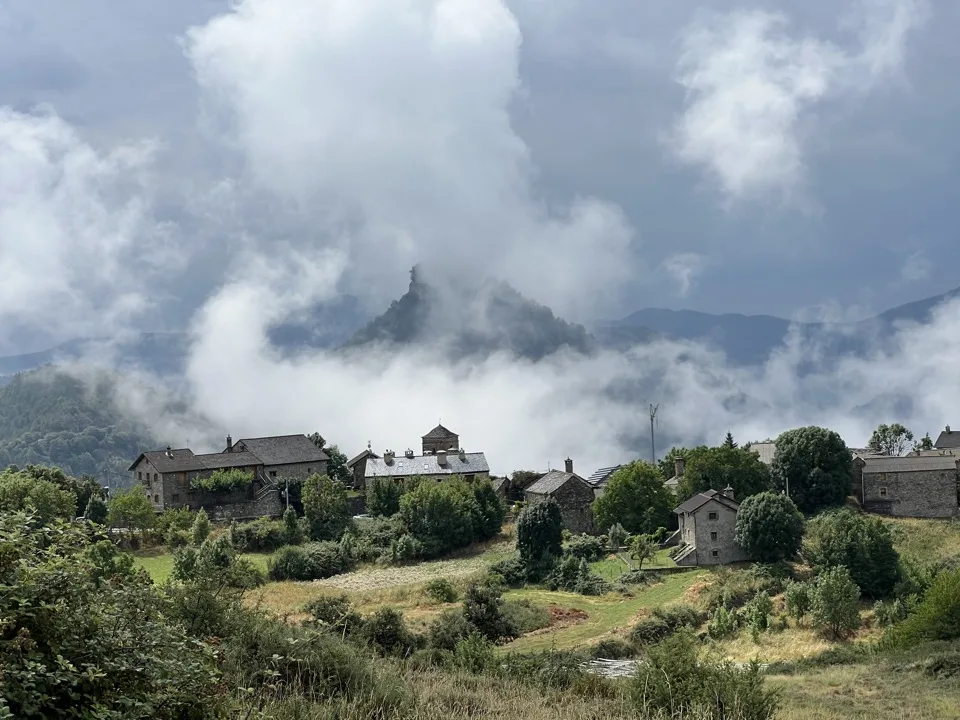
The Murallas de Finestras are magnificent! Nature never stops surprising us with the beauty of its formations! It’s a wall of huge rocks cutting through a turquoise lake. A real gem, sometimes nicknamed “the Spanish Great Wall” (but it’s only a few metres long). The hike itself is simple, with very little elevation gain. The trail is marked, but it’s missing a few signs at times. Overall, you need to follow the signs to Mirador de San Marcos. Along the way, you pass through the abandoned village of Finestras, once prosperous when it produced olive oil.
Warning! To reach the start of the hike, you have to drive for a long time on a track, and the route isn’t easy to find! I’ll remind you that if you have a hire car, you’re not allowed to drive on tracks as you wouldn’t be covered if something went wrong. With your own vehicle, take care as well: there are two possible tracks, and one is in bad condition! Which is the right one, you ask? Take the road that leaves the N-230 heading south towards Viacamp. The road turns into a track after several kilometres. From the N-230 to the point where you can start the hike (La Creux), it’s 16 kilometres. There are many junctions. Google Maps won’t show you the way, so check a map like Organic Maps before you set off. Finally, don’t attempt the track in rainy weather.
In short, I hesitated to tell you about this hike because you really need to prepare your driving route and have a good sense of direction. In terms of scenery and adventure, the next hike is in the same area, on the same lake, and without access issues, so it’s a great alternative.

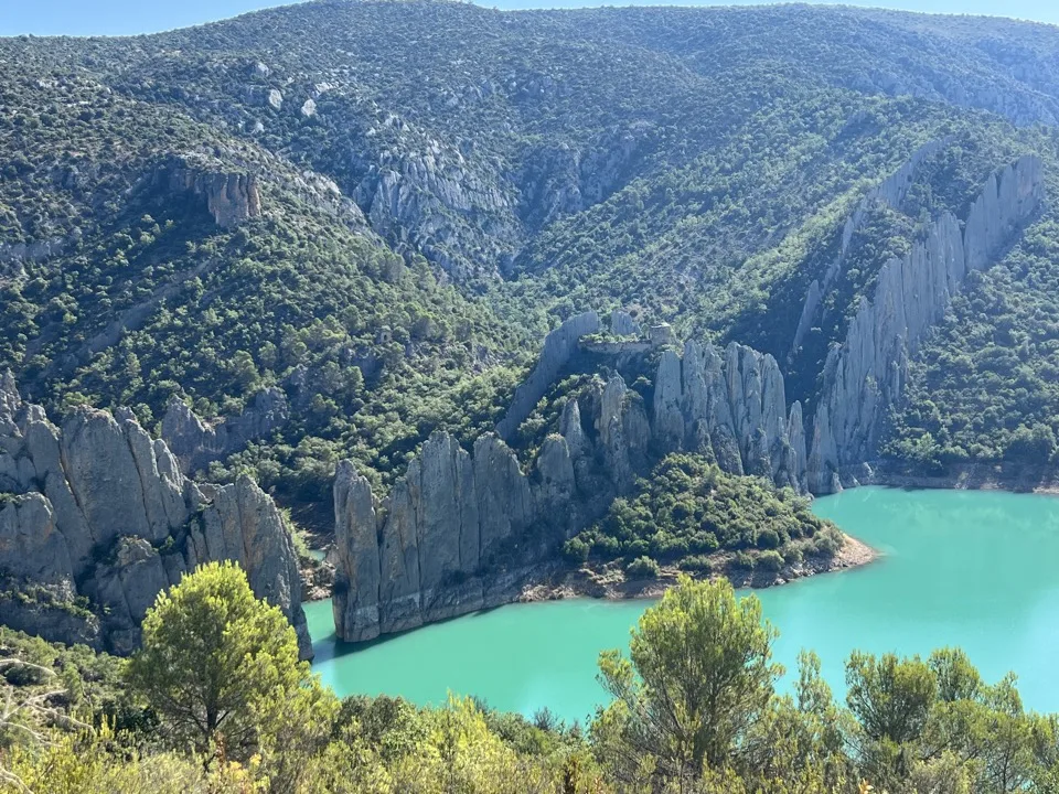

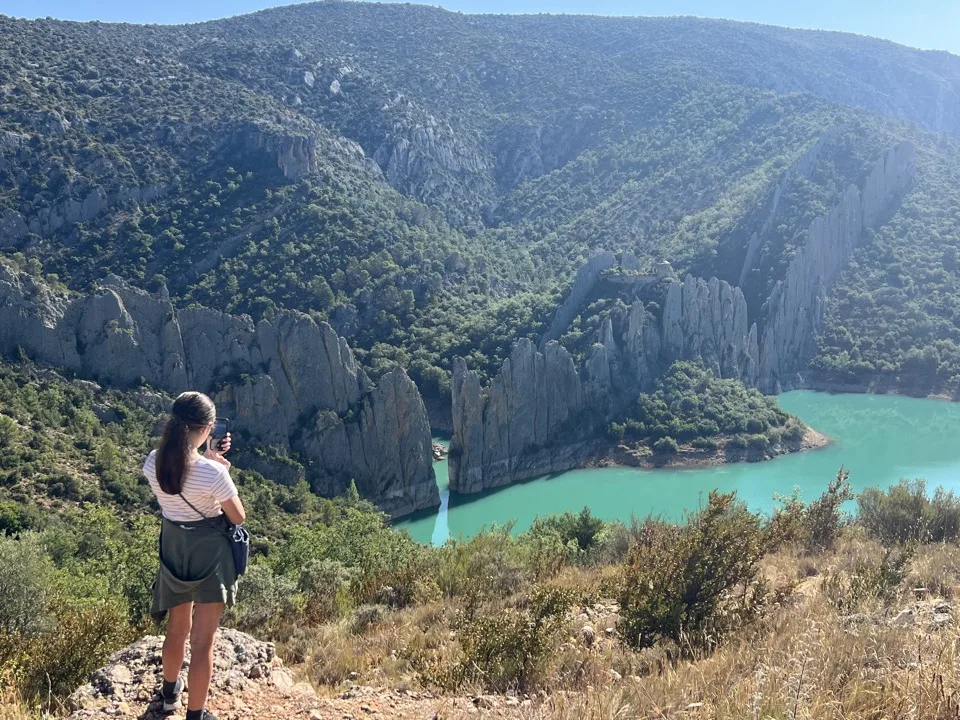

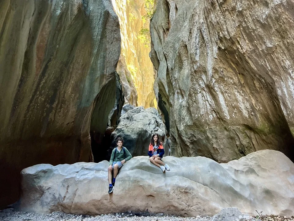
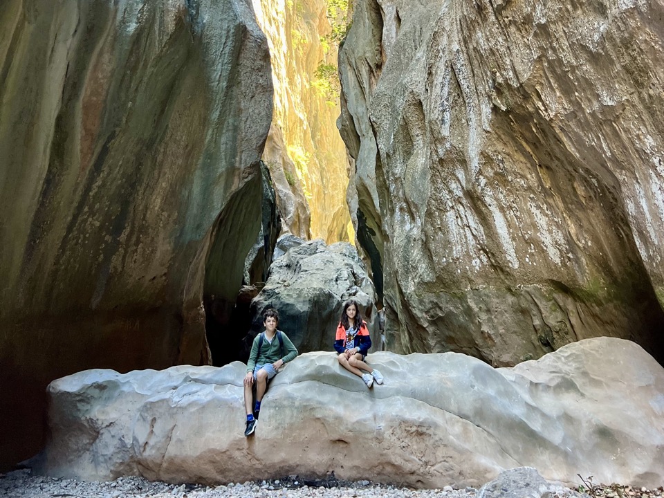
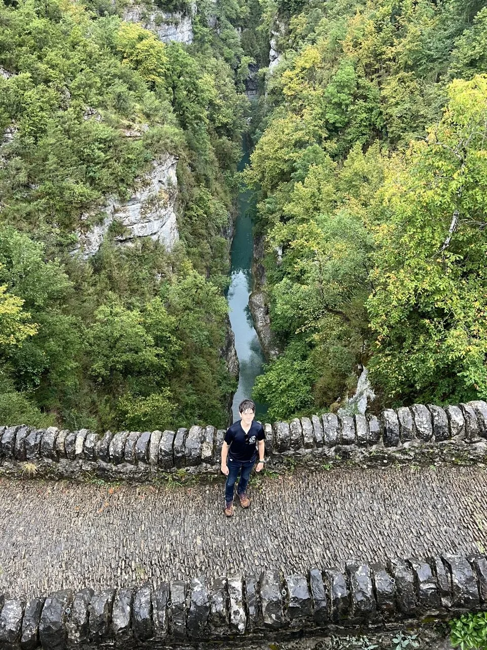
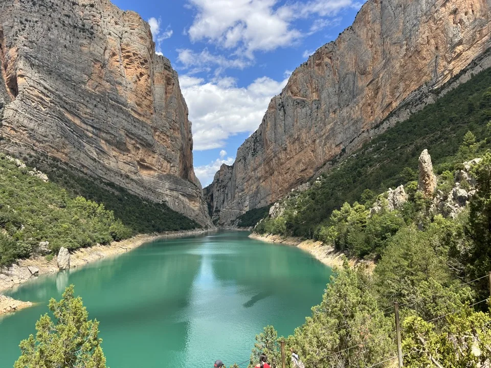
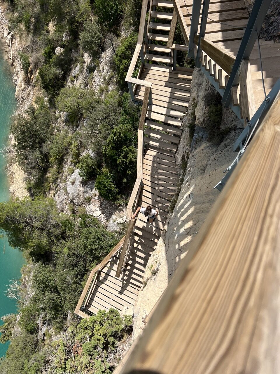
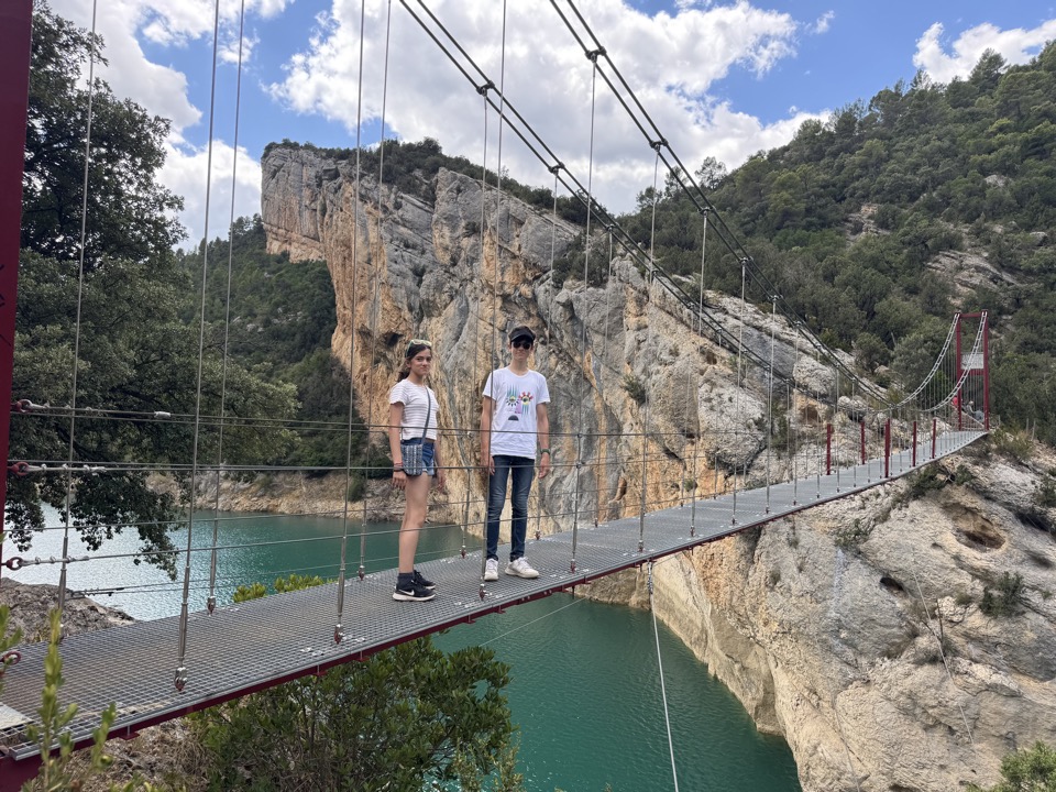
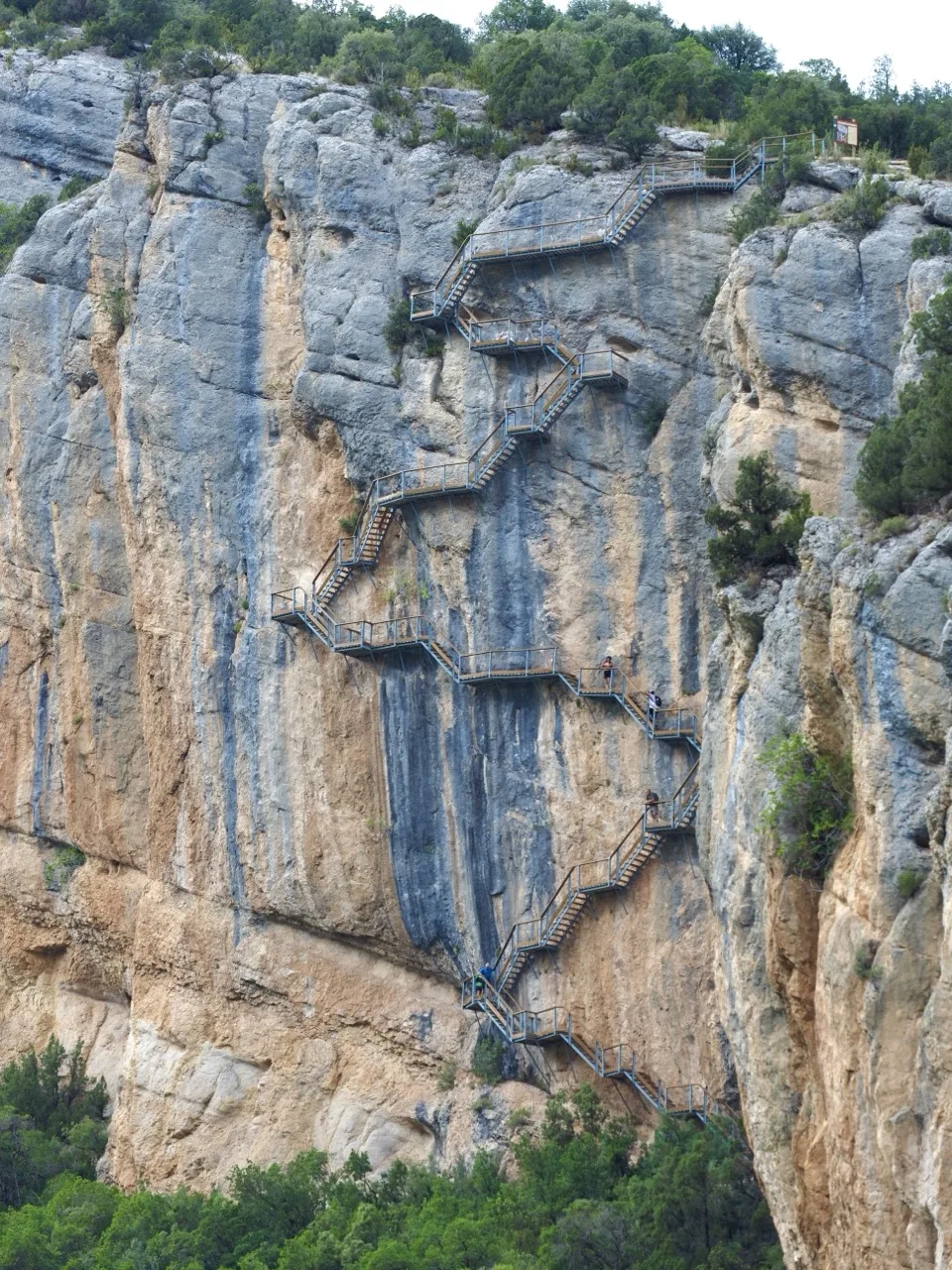
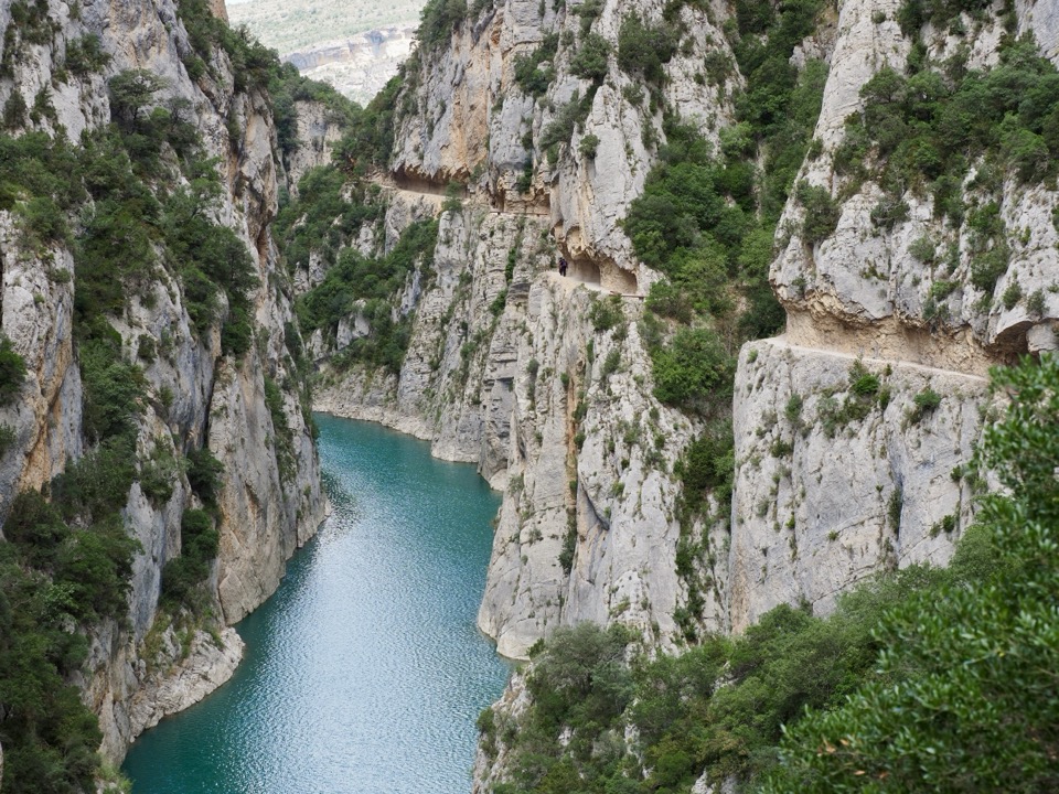
7 – The Congost de Mont-rebei hike (Sierra del Montsec)
Difficult hike – 9 km out-and-back on the GR1 – about 5 hrs return – big elevation changes – lots of steps: watch out if you’re afraid of heights!
Still in the Sierra del Montsec, on the same lake as the previous hike, but without any issues getting there by car.
The Congost de Mont-rebei hike is the hardest hike of our road trip in Aragon! It’s very sporty because the elevation changes are significant and it’s long! Even though we were very lucky with the weather and it was only 25 degrees, it’s still pretty warm for that much climbing! Along the way, there are lots of stairways cut into the mountainside above the lake. Clearly, if you suffer from vertigo, you can forget it! It’s really impressive! Papa Voyage even felt a bit of vertigo, which is rare for him. Midway through the hike, you reach a suspension bridge that takes you into Catalonia. After this bridge, the path becomes very narrow and is carved into the rock several metres above the lake. We walk to the first viewpoint, then turn back because we feel this section isn’t safe enough: there are quite a few other hikers, so we’re worried about having to pass each other on this narrow path with the drop so close!
The stairways, on the other hand, are very reassuring and solid.


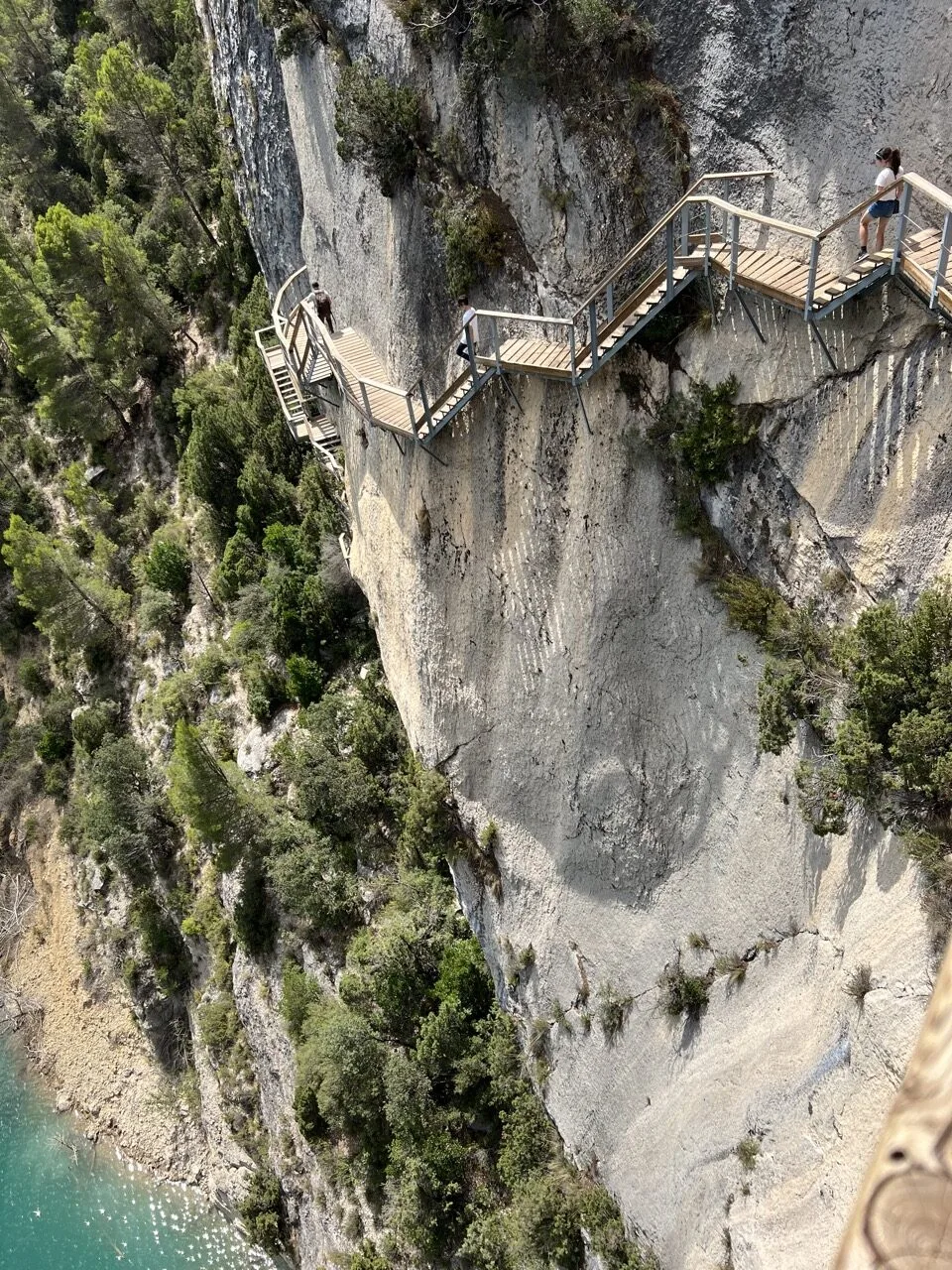


 In this photo, you can see the section that didn’t feel safe enough to us
Shorter option: you can turn back at the bridge. You’ll have seen the essentials and, in that case, you cut 2 km off the hike (about 1 hour 30 minutes less).
Easy option: hire a canoe/kayak on the lake to enjoy the scenery without hiking.
Back at the start of the hike, we had a drink at Montfalcò inn, just by the car park. Then we drove west in Aragon to visit the villages with mallos the next day.
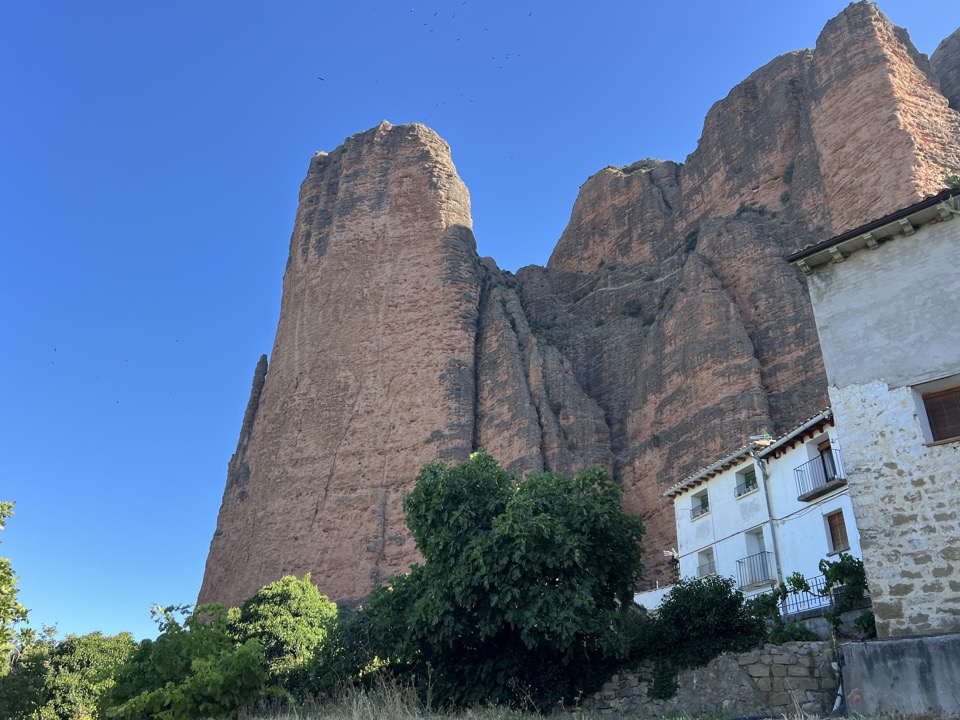
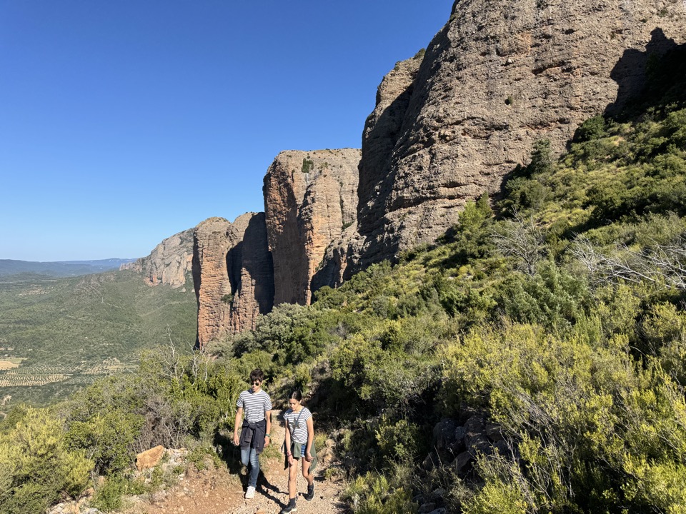
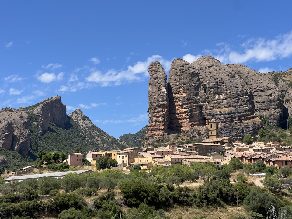
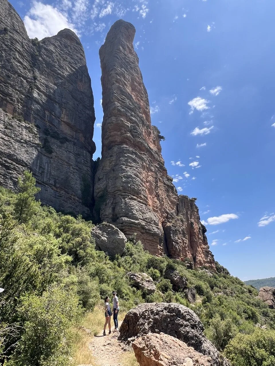
8 – Mallos de Riglos – El camino del Cielo
Easy loop – 2 hrs – about 5 km
The mallos are impressive giant formations, reddish in colour, found in western Aragon. The highest monoliths are 300 metres tall! There are several villages with them. We started with the Mallos de Riglos and did the El camino del cielo loop to see the mallos from every angle.


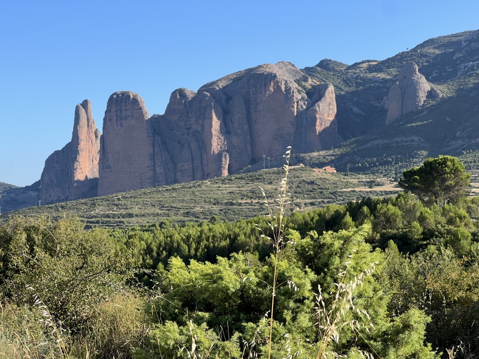
We then found a nice spot with a view of the Mallos de Riglos for a picnic.
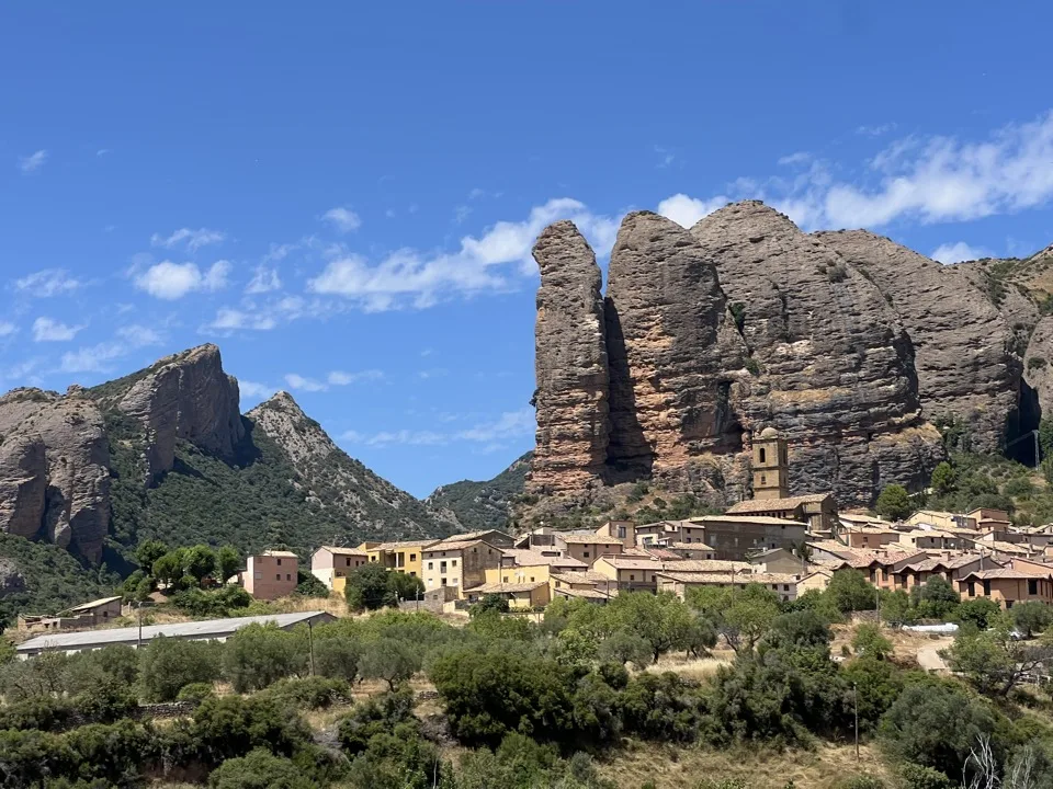
9 – Mallos de Agüero
Easy loop – 1 hr – 2.8 km
In the afternoon, we followed up with the Mallos de Agüero. The formations are similar, but the village is cuter. It’s particularly photogenic as you approach it! We did the loop around the mallos. It really adds something to see them from every angle!

Not far from the mallos, we passed in front of the Loarre Castle. We stopped briefly to admire it. You can visit it: more info on their website.
Where to sleep in the mallos area?
Night in our van, wild camping.
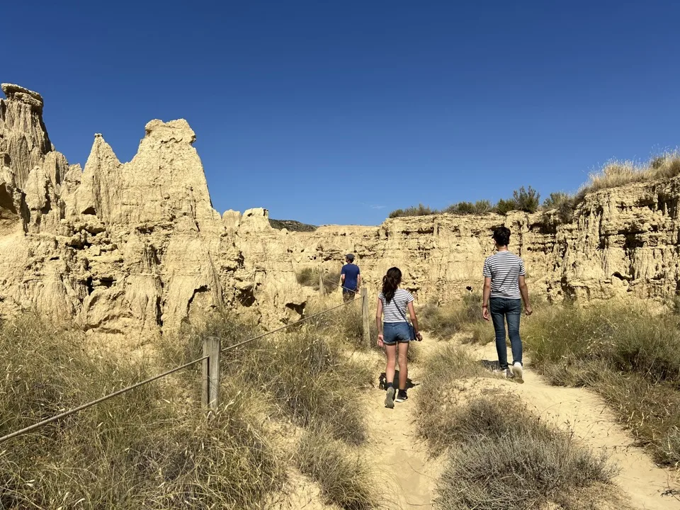
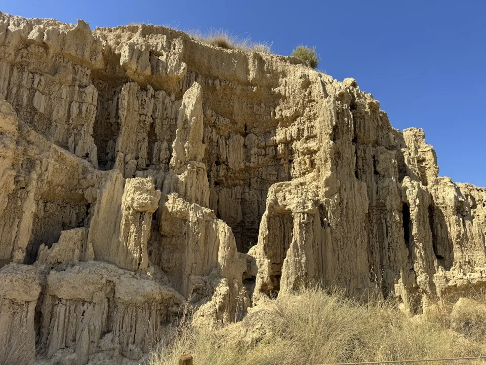
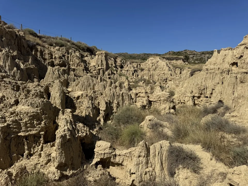
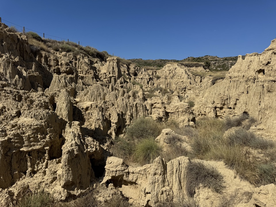
10 – Los Aguarales de Valpalmas: a mini Bardenas
Easy – 30 minutes
By chance, while looking on Google Maps not far from the road we were driving on towards Zaragoza, I spotted a tiny, non-touristy geological site, a little off to the side. It’s very, very small, so don’t go out of your way for it, but if it’s also on your route, it’s pretty in the late-day light and it’s in the style of the formations in the Bardenas desert. We walked for half an hour surrounded by these ochre-coloured formations.


***
Summary of our itinerary and our 10 hikes in Aragon, day by day:
We chose to go to Aragon the day before our holiday by looking at where the best mountain weather was at the time (not too far from France). Safe to say we hadn’t prepared this trip at all! That’s the advantage of travelling by van! So our programme was completely improvised, day by day. I’m not claiming it was optimised. It was our pace at the time.
We spent 6 nights in Aragon:
- Monday: arrival in the evening in Monte Perdido – night in Monte Perdido in Torla.
- Tuesday: Hunter’s Trail hike (Hike 1) – old town of Aínsa – walk at Embalse de Mediano (Hike 2) – night in Boltaña.
- Wednesday: hike in Añisclo Canyon (Hike 3) and the walkway hike in Alquézar (Hike 4) – night near Alquézar.
- Thursday: canyoning hike in Peonera Canyon (Hike 5) – town of Graus – night south of Graus
- Friday: in the Sierra del Montsec: hike to Murallas de Finestras (Hike 6), then Congost de Mont-rebei hike (Hike 7) – night near the Mallos de Riglos (it was a huge day!!)
- Saturday: villages and short hikes at Mallos de Riglos (Hike 8), then Mallos de Agüero (Hike 9) – on the way to Zaragoza, walk at the mini Bardenas (Hike 10) – evening and night in Zaragoza.
***
Family hiking in Aragon: our practical tips
How to get to Aragon?
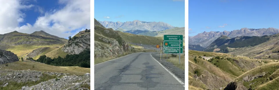
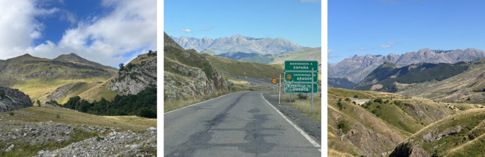
We drove across France from Paris and stopped at friends’ in Pau. After a quick stop to stock up on Ossau-Iraty cheese, we crossed the border in the Pyrenees at Col du Pourtalet. Then we drove on to Monte Perdido. The road through the Pyrenees was very beautiful.
Weather:
We were very lucky because it wasn’t too hot! We had 25 degrees, which is mild for July. In a heatwave, our hikes would have been impossible. So I think to visit the region, it’s better to aim for late spring, or do like us and improvise at the last minute after checking the weather forecast. We had only sunshine except for our isolated but memorable storm!
River levels:
For canyoning, you need a good water level in the rivers. For that, late spring is the recommended period. We were lucky to still have plenty of water because the spring had been exceptionally rainy! Sometimes, in summer, some canyoning routes aren’t possible, including the one we did.
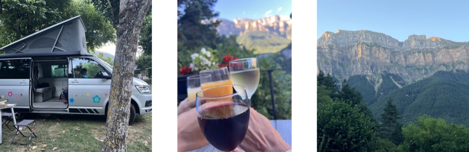
In a campervan:
We really appreciated the freedom offered by a van trip because we could improvise the stops, the choice of hikes and where to sleep. For campsites, we had no trouble finding space without booking, except the first night in Monte Perdido: several campsites were full, and the one where we stayed had only one pitch left! We were there in the 3rd week of July. A bit later in the high season, it’s better to book. In the lower part of Aragon, we mainly slept wild camping, in very isolated spots, while respecting nature of course. We found these spots on Park4Night.

Equipment:
As always for hiking, we had comfortable clothes, good shoes, caps, windbreakers, sun cream, water and snacks. I’d also recommend having a spare outfit in your vehicle, especially socks: that came in very handy after the storm! For canyoning, the helmet and wetsuit are provided by the guide. But you wear your own trainers, so bring a pair you don’t mind ruining.
***
After Aragon, we continued our family road trip in northern Spain with a day in the Bardenas desert!